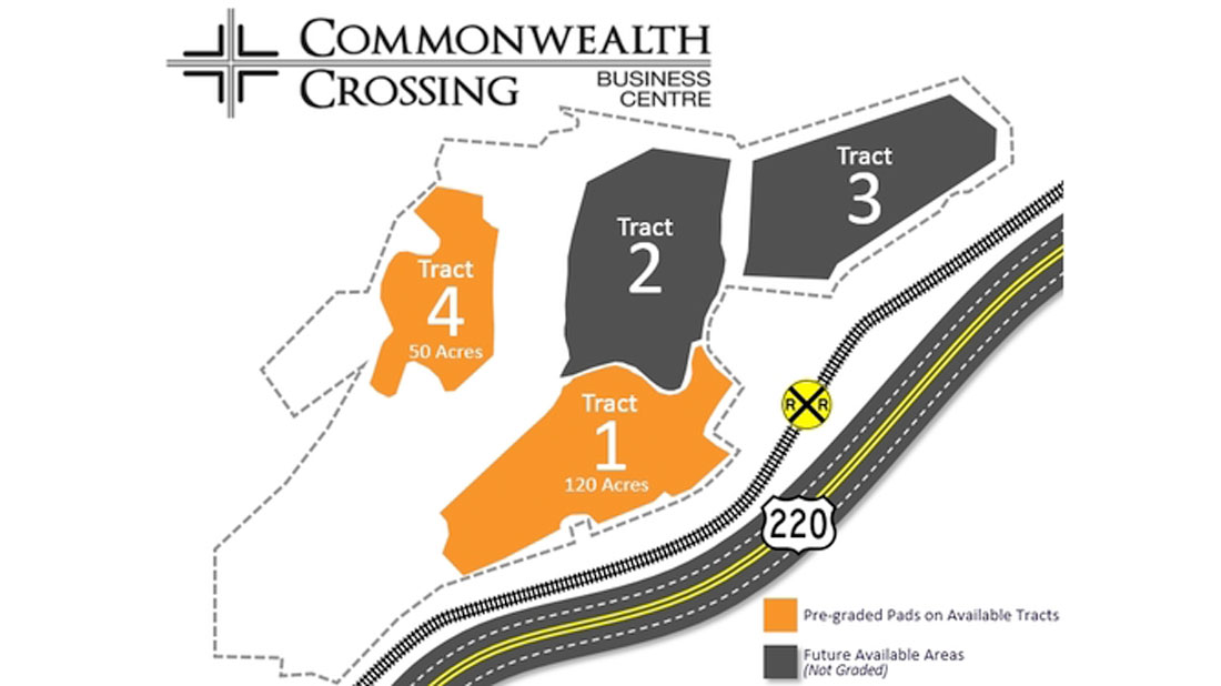
Project Description
Client
Henry County, VA, Engineering and Mapping
Tim Pace, PE
(276) 634-2559
tpace@co.henry.va.us
Location
US-220 and Reservoir Road, Ridgeway, VA 24148
720+/- Acres
Markets
- County Government
- Economic Development
Solutions
- Digital Photogrammetry
- Airborne LiDAR
Services: 2008, 2009, 2015, 2016 and 2017
- Project Technical Planning
- Digital Airborne Imagery, Airborne-GPS (GNSS-IMU)
- Digital Aero-Triangulation
- Digital Planimetric Mapping at 1”=50’ and 1”=100’ Scale
- Digital Topographic Mapping at 1-Foot and 2-Foot Contour Intervals
- Digital Terrain Model Feature Mapping (DTM) – High Accuracy
- Digital Orthoimagery at 0.25-Foot and 0.5-Foot Pixel Resolution, 8-Bit RGB
- Internal Level-1 Macro Quality Control and Assurance
- MrSID Processing and Composite Mosaic
- Project Technical Reporting